 MENU
MENU
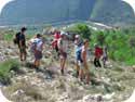
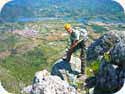
Mountain Navigation in Spain
Maps

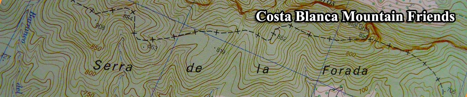
The most popular map for mountain navigation in the Alicante and Valencia provinces has been the Mapa Topográfico Nacional de España in scale 1:25.000. This map is based on the European 1950 UTM Datum grid reference system.
In 2010 two new topographic maps came on the market and these cover the Marina Baixa and Marina Alta areas. The scale is 1:20.000 and the maps unfold to 88 x 76 cm.
The detail is very good and includes hiking trails.
A list of book shops stocking them can be viewed at the distributors web site Terra Ferma.
Navigating by GPS or compass

For navigation by GPS your receiver will need to be set as below but you should run a local test in Spain before departing your accommodation for the mountains.
Position Format-UTM UPS. Map Datum-European 1950.
Warning, GPS satellite signals are constantly lost in the mountains so don’t rely on GPS alone. Mount your GPS receiver on your body and not in your rucksack!
When exploring new routes you should always carry a map and compass and plan your courses by marking them on the map. As you pass each planned course make sure that you take a back bearing of the original course. Back bearings are useful for when returning on the original route particularly in poor weather conditions.
Magnetic variation is normally stated on Spanish topographic maps but will need to be calculated for the current year if the map is an old edition. For 2020 the magnetic declination for Dénia was +0° 53’ so
adjust any course that you have calculated on your map. Remember that in the mountains there could also be some local magnetic deviation, just like at sea.
However, such small variations will have little effect on short routes.
Add this variation to any course that you have calculated on your map. Remember that in the mountains there could be some local magnetic deviation just like at sea.
However, such small variations will have little effect on short routes.
A compass in your rucksack should be kept away from any metallic objects to avoid weakening of the magnetic properties of the needle pointer. Also note that for reliable navigating in different hemispheres a global compass with a precision bearing is required.
Position locating by altitude is only accurate if you have calibrated your altimeter prior to the event. Remember that the atmospheric pressure which altimeters rely on changes during the day and decreases with altitude as you climb. GPS devices have a built in altimeter which is regularly updated by satellite so calibration prior to the event is useful but not so important.
Altitude reference is a useful tool for navigating. You can use the altitude reading in conjunction with a map to determine your nearest height contour line. Use contour lines to help locate your approximate position.
All position coordinates on this website are in decimal degrees for use on Google Maps. The coordinates can only provide mobile phone guidance when on public roads. Where off–road coordinates are shown you will need to either, find your own route to the indicated position or use a hiking app covering the area. Most of the off–road coordinates shown on my Routes pages can be reached quite easily by just following an obvious track.
Route Markings

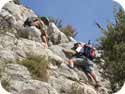
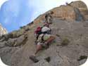
Most of the well known mountain routes are marked by the local town Halls with white and yellow or white and green stripes. Some of these routes are sign posted and prefixed with PRV which stands for Pequeño Recorrido Valencia. GR stands for Gran Recorrido and marked with white over red stripes. GR routes are frequently seen in the Spanish Pyrenees. Routes marked with red, orange, green or any coloured spots are not official and are made by local hiking or climbing groups. These spots may be a useful guide for others but they could be leading you onto a scrambling, canyoning or rock climbing route, so be aware!
Cairns are constantly used for route marking and are visible over longer distances than paint spots. However, cairns become damaged by animals or weather which can leave you searching for the next one. Cairns could also be leading you on to an extreme mountain route or in a direction other than your intended route.
Measuring your distance is essential when in unfamiliar mountains, in poor visibility or at night. Pacing and timing your progress should be done by counting your steps on each section of your route plan. Practice measuring your step distance and remember it or mark it on your map or compass. If your average step is 0.8 metres and the next waypoint or change of course is 100 metres then you will need to pace out 125 steps. Remember that your step will vary so allow a tolerance of about 5%.
Mountain Weather

Thankfully we don’t receive much mountain mist or fog in the Costa Blanca area but be aware of the following conditions when it does occur.
Advection fog or Sea Fog is normally formed in coastal waters when the air is cooled below it’s dew point allowing water vapour to condense into fog. Mountains and cliffs such as Gelada, Oltá, Montgó and the Plana de San Jerónimo can be partially covered in the cold months. A change of wind direction bringing drier air will clear this type of fog.
Radiation fog is formed by land cooling at night and radiating it’s heat into space. If the air is cooled by land below it’s dew point then condensation occurs and if conditions are right, this will form fog. This type of fog normally occurs in the hotter months and will affect all mountainous areas but clears quickly as the sun rises and heats the land.
Low pressure weather cold fronts bringing in Cumulonimbus clouds can reduce visibility down to 10 metres in areas above 500 metres. The showers that normally accompany these cold fronts can leave you in dangerous conditions particularly on mountain summits.
Apart from the poor visibility and becoming disorientated there is the obvious danger of a fall on slippery rocks and a serious injury with very little chance of the rescue services locating your exact position.
These conditions normally occur in the cold months and taking local weather reports coupled with your own regular observation of the sky should keep you out of trouble.
Avoid all summits and ridges if these conditions are imminent.
Weather conditions in the Spanish Pyrenees are much more extreme and dangerous. Regular checks with online weather web sites is essential and making your descent by early afternoon is wise.
The distance you can see from summits in good visability.
Plana de San Jerónimo. 49 kilometres
Serra de Segária. 86 kilometres
Serra d’Oltá. 94 kilometres
Serra del Montgó. 106 Kilometres
Serra de Mondúver. 112 kilometres
El Puig Campana. 146 kilometres
The distance from the Marina de Dénia to the island of Ibiza is 117 kilometres and 239 kilometres to the island of Mallorca.
Mountain Navigation in Spain is written by Vic Warth Yachtmaster Navigator
All heights, distances, times, grades and equipment and other information listed on this page are provided in good faith as experienced by the author but may include errors. Anyone attempting these routes should verify the information before commencing the activity in case of errors, route modifications or geological changes.
1. A hike is a long walk. 2. Ascent figures are accumulative starting from the car park. 3. Duration of the event includes short stops, a short lunch break and brisk pace. 4. Distance and ascent figures have been derived by GPS. 5. Position coordinates are in decimal degrees. 6. Spanish names are entered in the Castellano or Valenciano form.